Megalithic monument: from the Greek for "large stone", in archaeology, a construction involving one or several roughly hewn stone slabs of great size, usually of prehistoric antiquity. These monuments are found in various parts of the world, but the best known and most numerous are concentrated in Western Europe, including Brittany, the British Isles, Iberia, southern France, southern Scandinavia, and northern Germany.
Aside from the standing stones and stone heaps that are still raised occasionally as boundary marks or memorials of personal and public events, most megalithic monuments seem to have been erected for funerary and religious purposes. The Western European megaliths were constructed during the Neolithic and the Bronze Age and are believed to range in date from circa 4,000 B.C. to 1,100 B.C. Most chamber tombs were probably built during the 4th millennium B.C., and the stone circles generally date somewhat later.
Megalithic monuments may be divided into four categories:
- the chamber tomb, or dolmen (from the Breton for "stone table", a burial chamber consisting of two or more upright stone slabs supporting a capstone or table, typical of the Neolithic period in Europe)
- the single standing stone, or menhir (from the Breton for "long stone", in archaeology, the name given to the single standing stones of Western Europe. Their size varies and their shape is rough and squared, tapering toward the top. Solitary standing stones on windswept heights are believed to be the work of a family group.)
- the stone row; and
- the stone circle.
Chamber tombs were usually covered with earth mounds, forming a barrow. Menhirs sometimes stood alone near the entrance of a tomb or on top of the mound. Sometimes they were set in long rows called alignments, as at Carnac in Brittany; in other places they were arranged in a circle, the most elaborate of which is Stonehenge in England (these are known as cromlechs outside Britain). The individual stone slabs may reach 65 feet in length and 100 tons in weight. Such massive structures testify to the engineering feats possible with the concerted efforts of relatively ill-equipped peoples.
See
- G. Daniel, The Megalith Builders of Western Europe (1958)
- A. Thom, Megalithic Sites in Britain (1967) and Megalithic Lunar Observations (1973)
- C. Renfrew, Before Civilization (1973)
- J. Mitchell, Megalithomania (1982)
- R. Joussaume, Dolmens for the Dead (tr. by A. and C. Chippendale, 1988)
 |
 |
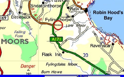
Nearest town: Whitby Nearest village: Robin Hood's Bay OS Sheet: 94 OS Map reference: NZ 92061 03774 |
Ramsdale Megalithic Stones:
|
 |
 |
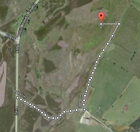 |
| Ramsdale Megalithic Stones (first route) | Ramsdale Megalithic Stones (alternative route) |
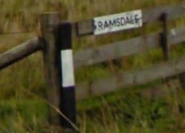
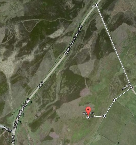
| First route: driving north on the A171 (Robin Hood's Bay Road) to Whitby, a half mile (825 metres) after the B1416 junction (at 54.4263, -0.5820) at 700ft altitude, a gate off to the right signposted Ramsdale leads over a cattle grid to a track across the moor. Approximately a third of a mile (500 metres) on, just over the brow of the hill, the track widens (54.42243, -0.57899) out where a small path crosses it. Turn right and continue down that path for 220 metres (725 ft) (54.42105, -0.58123). Branch off across the moorland to the right walking due west for a further 98 metres (320 ft) and up to a raised area near a tumulus. | Alternative route: driving north on the A171 (Robin Hood's Bay Road) to Whitby, 277 metres (909 ft) before the B1416 junction (at 54.4263, -0.5820), take the farm track running south east for 362 metres (a fifth of a mile) and follow the track as it swings north east for 538 metres (a third of a mile) and then turn and walk due west for 98 metres (320 ft). |
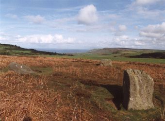
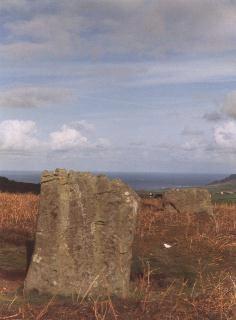
The three stones that make up the Ramsdale circle stand just over two miles from Robin Hood's Bay and on a clear day the fine views eastward towards the sea provide a fairly persuasive reason as to why this site was chosen to erect the stones as well as the round barrows located a short distance to the west. It is not recorded if there were more than three stones here but it seems likely that at least one other stood to form a square setting known as a four-poster or perhaps several others to make a true circle, alternatively the stones may have been part of a kerb or revetment around a vanished burial cairn.
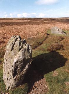
What remains today is an isosceles triangle of three rough boulders, the largest stone to the north leans out from the circle and would have stood 6 feet tall while the other two each stand 18 feet away to the west and east. These are slightly smaller, standing just under five feet in height with the western stone appearing narrower than the more squat flat topped stone towards the east, all three show evidence of weathering.
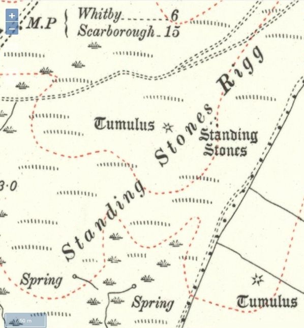
The stones stand on a gentle southeast slope of land to which they give their name - Standing Stones Rigg - but just over 100 yards away the land falls away more rapidly to the valley formed by Ramsdale Beck as it flows eastwards on its journey to the sea at Robin Hood's Bay. Futher to the southeast the raised plateau of Stoupe Brow is clearly visible and just beyond this is one of the richest concentrations of prehistoric carved rocks in North Yorkshire on Brow Moor and Howdale Moor.
 |
 |
 |
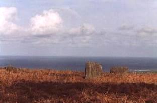 |
| On a spur of high ground this site has a superb view from Ramsdale out across Robin Hood's Bay | |||
Ramsdale Stones Timelapse.
Timelapse of clouds and sunbursts at the Ramsdale Stones in North Yorkshire with Robin Hood's Bay in the background.
These three stones are thought to be the remains of a stone circle.
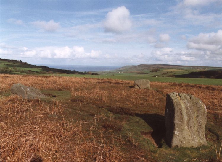
Ramsdale Megalithic Stones
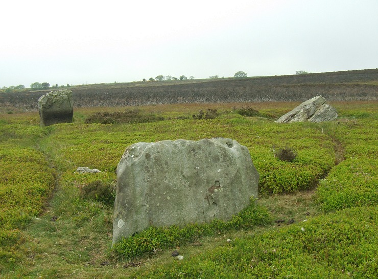
Ramsdale Standing Stones
